Indonesia Implements One Map Policy to Overcome Spatial Data Challenges

- FMB9


Jakarta, VIVA – Indonesia, with its rich natural resources and diverse geography, faces significant challenges in land management and utilization. To address these issues, the government has launched the One Map Policy (OMP), aimed at providing standardized, data-driven geospatial references accessible through a single geoportal. This initiative is designed to support sustainable policy-making and development planning.
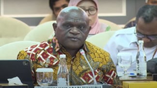
Wahyu Utomo, Special Staff for Regional Development Acceleration, Infrastructure Development, and Investment Coordination at the Coordinating Ministry for Economic Affairs, explained that the OMP was motivated by the need to accelerate national development, often hindered by overlapping geospatial data.
"In 2016, the government aimed to expedite infrastructure development as a priority to escape the middle-income trap. Accurate map availability is crucial in this process," he stated during the Forum Merdeka Barat 9 (FMB9) dialogue themed 'One Map, One Data for One Indonesia' on Monday (5/8).
The OMP involves compiling, integrating, synchronizing, and developing an accessible geoportal. By 2016, a mandate was issued to compile 85 thematic geospatial information maps. Most thematic maps have reached near-complete integration, with only one or two maps pending full integration.

Stafsus Kemenko, Wahyu Utomo
- FMB9
"Synchronization is essential to ensure ongoing development is not obstructed by land overlap issues. Unsynchronized maps will be corrected accordingly," Wahyu emphasized.
The integrated map allows central and regional governments to use it as a reference for policy-making, planning, and development. The OMP also underpins the Online Single Submission (OSS) system, simplifying licensing and investment processes in Indonesia.
"With one standard, one database, and one geoportal, the OMP is expected to support better and more efficient governance, fostering sustainable economic growth," Wahyu hoped.
Virgo Eresta Jaya, Director General of Land Surveying and Spatial Planning at the Ministry of Agrarian Affairs and Spatial Planning/National Land Agency (ATR/BPN), highlighted that the OMP is a dynamic journey, continually evolving with field developments.
"The OMP will continue to grow and provide greater benefits in the future. Integrated maps enable local and central governments to use this data as a primary reference for licensing, development, and planning," he noted.
Challenges include land certification hindered by forest boundaries and protected rice fields, and spatial planning, forest area management, and mineral resource issues. Virgo stressed the importance of collaboration among communities, ministries, and agencies.
"We hope that communities and relevant entities set boundary markers while we improve the maps for inclusion in the OMP," he said.
Danang Sri Hadmoko, Dean of the Faculty of Geography at Gadjah Mada University (UGM), praised the policy as crucial for Indonesia's future.
"One map is essential, urgent, and a priority because geospatial information is necessary for governance and all governmental activities," he asserted, noting that other countries like Singapore, South Korea, and European nations are more advanced in data integration. He emphasized that Indonesia’s unique geography requires tailored approaches.